


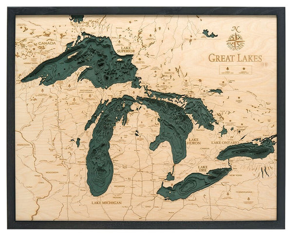


WoodChart's beautiful map of the Great Lakes. A 3-D nautical wood map of the Great Lakes region.
The Great Lakes are a collection of freshwater lakes which connect to the Atlantic Ocean through the Saint Lawrence Seaway and the Great Lakes Waterway. Consisting of Lakes Superior, Michigan, Huron, Erie, and Ontario, they form the largest group of freshwater lakes on Earth, containing 21% of the world's surface fresh water.. When you’re searching for unique gift ideas for the aquatic lover in your life, look no further than a Great Lakes nautical map.
Points of Interest Include:
Chicago, Milwaukee, Detroit, Cleveland, Niagra Falls, ,
Our wood charts are made from high-quality birch and have a solid wood frame. They come ready to hang and we will provide free shipping within the continental United States.
NOW AVAILABLE IN 3 FRAME STYLES! Choose between our classic, dark brown frame, grey frame, or our White Frame